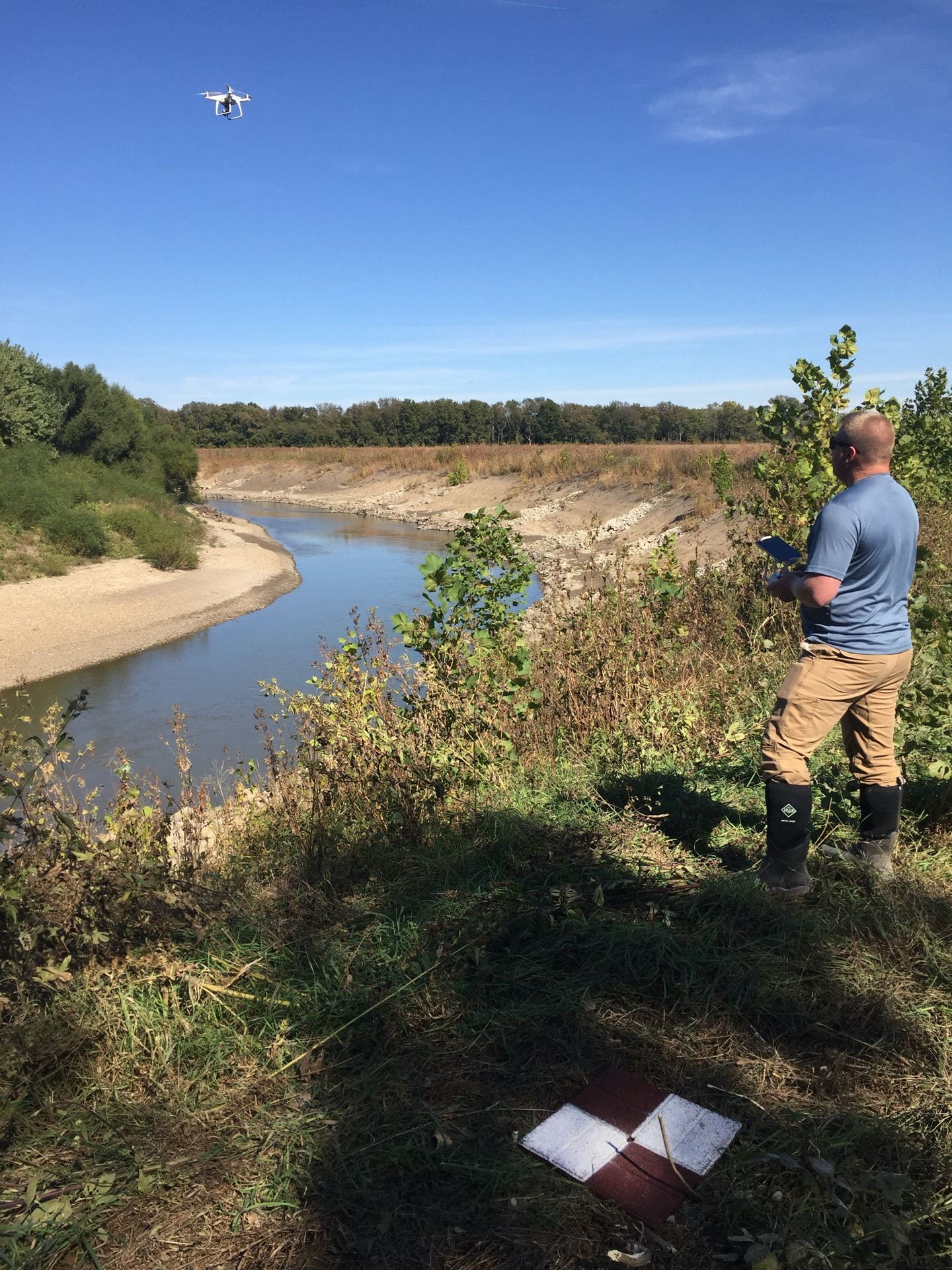
Multiple unmanned aircraft systems (UAS), or drone, flight tests were performed at one stabilized streambank site. Continue reading “Assessing the effectiveness of streambank stabilization projects on the Cottonwood River using UAS”
Multiple unmanned aircraft systems (UAS), or drone, flight tests were performed at one stabilized streambank site. Continue reading “Assessing the effectiveness of streambank stabilization projects on the Cottonwood River using UAS”
Shallow aquifers are heavily used for drinking water and irrigation. These aquifers are often part of multi-layered systems where confining layers, also known as aquitards, can “isolate” an aquifer from poorer quality waters that can lie either above or below them. The aquitard’s capability to isolate is estimated using the vertical component of hydraulic conductivity (K). Accurate estimates of vertical K are needed when it comes to protecting groundwater used for human supply.

This project investigated different methods, both hydraulic and chemical, to estimate the vertical K of an aquitard in the field. The key questions commonly faced by practicing hydrogeologists are what method is the most appropriate for a particular application, and how much uncertainty is associated with the method selected. To answer these questions, the research team tested two common approaches for aquitard K characterization at a Kansas Geological Survey field site. The first was a chemical method based on porewater concentrations at different depth intervals; the second was a hydraulic method based on the monitored pressure at different depth intervals in response to well constructions and water level fluctuations in the underlying aquifers. Continue reading “Contaminant barriers or pathways? Hydraulic and chemical methods to improve characterization of shallow aquitards”