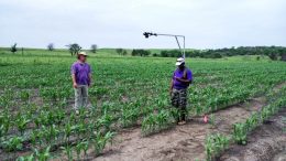
Soil erosion causes severe soil degradation and significantly contributes to soil loss in agricultural fields, with some producers losing substantial amounts of arable land each season.

To combat this soil loss, it is important to understand the mechanisms related to ephemeral gully formation and location, as well as the geomorphological properties related to storm characteristics. This three-year project works focused on these goals, as well the quantification of soil loss in Kansas resulting from ephemeral gully erosion.
In the first and second years of the project, investigators established field measurements and collected continuous and survey data for three gullies. In the project’s second year, they also developed a framework for an integrated channel erosion model and tested it on a collection of rainfall events applied to the studied gullies. In the project’s final year, the computer model was applied to more rainfall and runoff events specific to gully developments between selected consecutive surveys.
Project Coordinator:
Aleksey Y. Sheshukov, Biological and Agricultural Engineering, Kansas State University