Christopher “Chip” Redmond, Kansas Mesonet, christopherredmond@ksu.edu
A prominent high pressure has once again built back in across the Central Plains with much warmer than normal temperatures returning. With a third heatwave this summer, many are interested in what the fall will provide in terms of harvest and planting weather. We will provide a very brief summary of the past, a look at the current and how that all plays a role in the coming months.
The Past
August was highlighted by the substantial heat wave towards the end of the month. Numerous daily records were broken, especially in the north-central part of the state. Temperatures were at/above 100F for much of the state for seven straight days. This was the result of the Southern Plains high pressure expanding northward and persisting through the period. The high pressure gave way with the influence of post-hurricane Hilary breaking it down with a potent cold front. However, when we look at the state as a whole over the entirety of the month, temperatures were only a preliminary 1.4F above normal, good enough to tie for 40th warmest August on record.
Precipitation on the other hand was 104% of normal, making it the 61st wettest August on record. Precipitation wasn’t equally distributed as the west/central divisions saw the most. Meanwhile, the east continued to develop increasing drought with the West Central division the driest, measuring only 68% of normal for the month. This was the result of an influx of moisture from post-tropical storm Harold getting wrapped into a stationary front from the influences of Hilary.
The Current
Over the first few days of September, the Southern Plains high pressure has expanded back northward again. This has resulted in substantial warm and dry conditions returning for the state. This is only making the drought situation that began to expand east in August worse. Additionally, it was a center point of the September outlook issued by the Climate Prediction Center (CPC) (Figure 1). Fairly good confidence exists in warmer than normal temperatures and drier than normal conditions for the state.
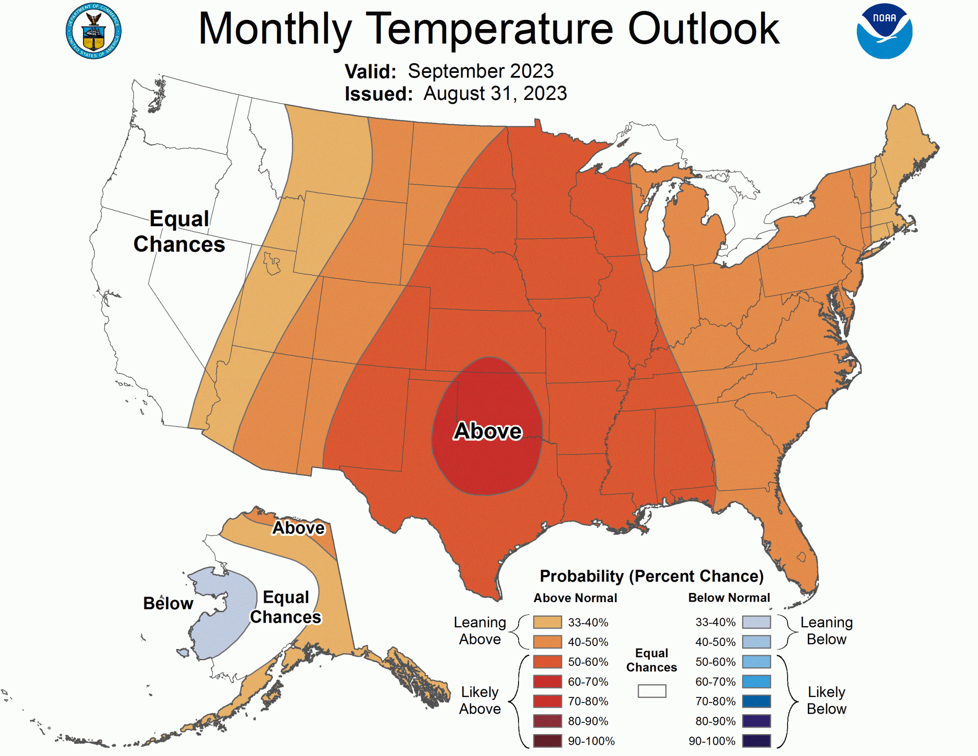
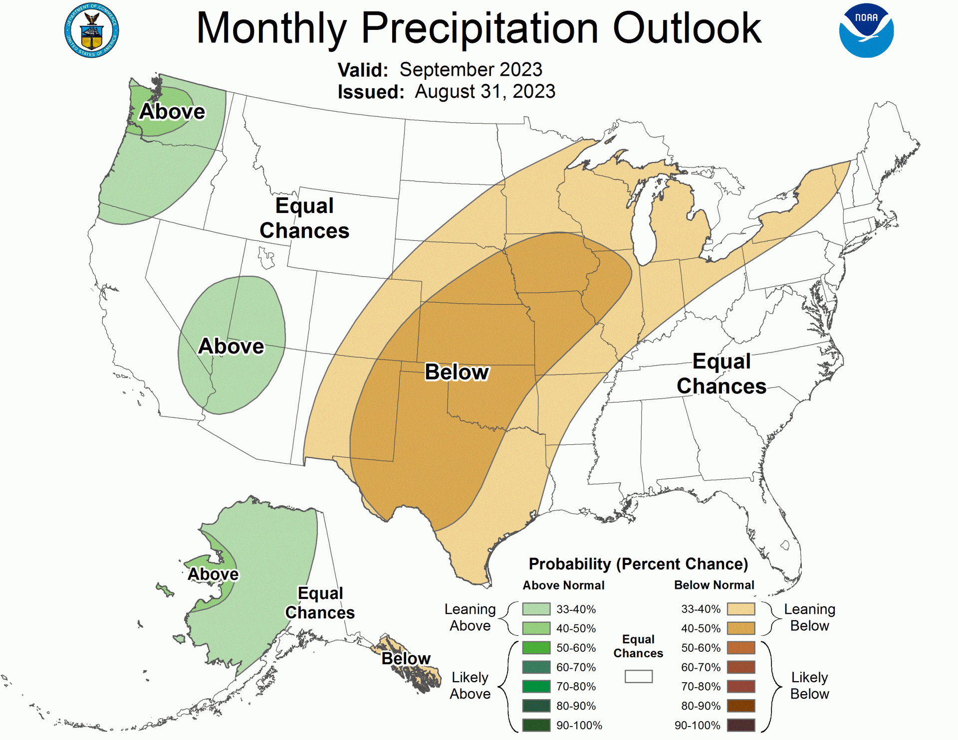
Figure 1b. Climate Prediction Center September outlook for moisture.
This is a look very similar to last September which ended much above normal temperature wise (3.4F above) and much below normal precipitation (less than 50% of normal moisture) in 2022. Typically, this month consists of decreasing moisture as we begin to approach winter (average 2.68” statewide). The heat of summer also begins to wear off with the statewide average temperature for the month being 68.1F. The hope is that we can have adequate moisture in time for post-winter wheat planting but also without hampering harvest. This can be a tricky forecast to fit the bill right for both.
The Future
The large high pressure is expected to shift west over the next week. This will allow a cold front to drop south into the Plains and stall somewhere in the vicinity of Kansas. This will be a welcomed relief with cooler than normal temperatures accompanied by a good influx of moisture (Figure 2). While the current outlook (Figure 3) suggests the opposite, keep in mind it averages over the entire month. It doesn’t represent singular events.
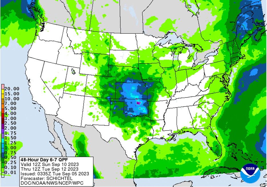
The current CPC outlooks beyond this weekend also hint at this pattern change remaining for the following week as well. This bodes hope that moisture won’t be as sparse as recent weeks and that substantial heat may be kept south and west thanks to the persistent stalled front. Precipitation through the period is likely to be in the form of thunderstorm complexes. These can drop substantial amounts of rain in isolated areas – but also miss many others. Therefore, widespread rainfall to overcome drought is not expected.
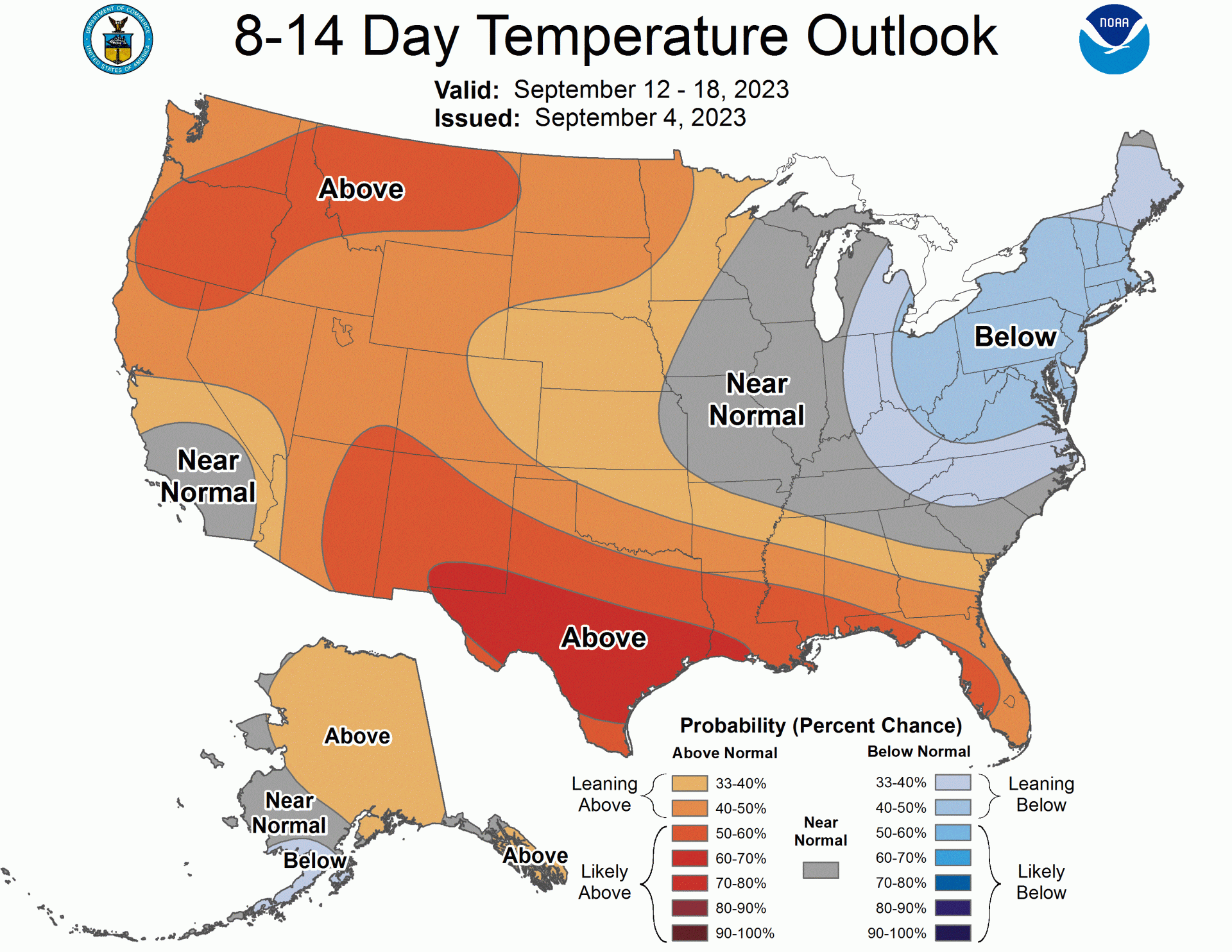
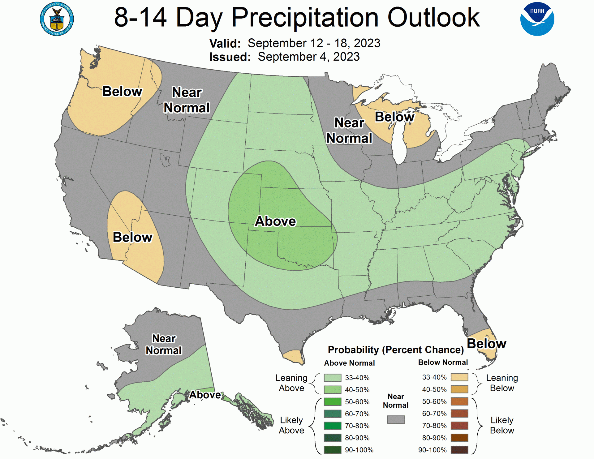
Figure 3. Climate Prediction Center outlook for the 12-18th of September.
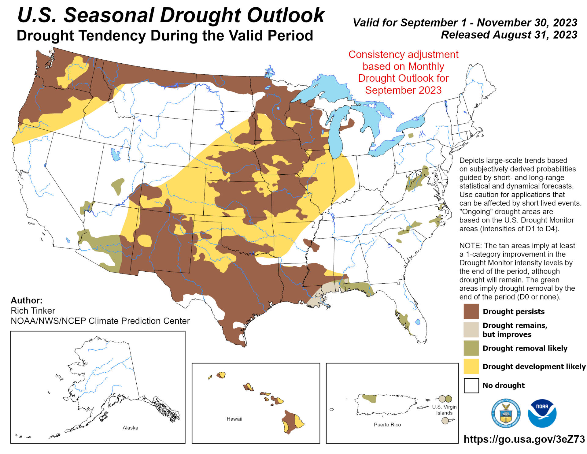
In fact, looking out further, the CPC has recognized that Central Plains drought is likely to expand during the fall months (Figure 4). This is unfortunate news for water supply concerns in eastern Kansas that really need a positive longer-term influx to improve stream flows and reservoir levels. This, however, would be a good result for harvesters that need ample dry conditions to get in the field.
The outlooks for temperature and precipitation take on a more El Nino look when we consider the CPC September through November outlooks (Figure 5). El Nino is best known for impacts of moisture in the southeast (and lack in the northwest) along with warmer than normal temperatures along the southern portion of the US. With an El Nino advisory in place and moderate El Nino ongoing, this is a major player to the outlooks of fall and winter. For Kansas, more uncertainty exists with equal chances of at/above/below normal temperature and moisture expected.
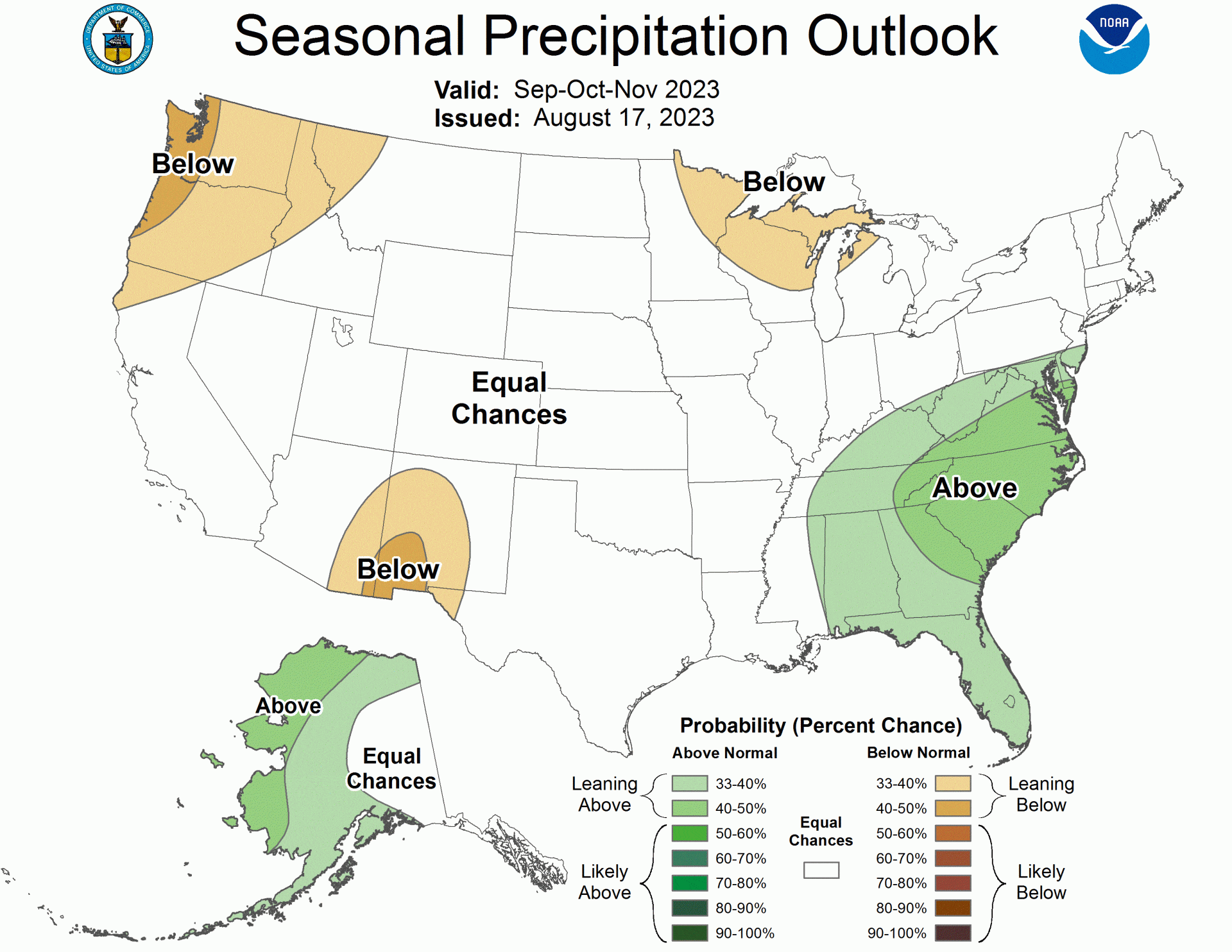
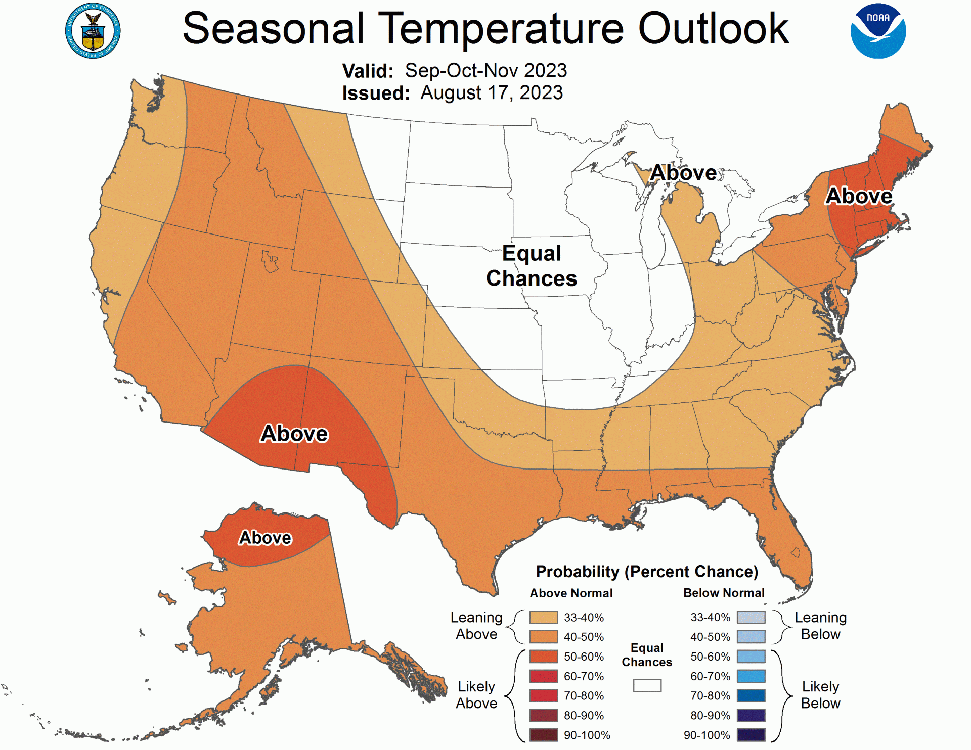
Figure 5. Climate Prediction Center outlook for September through November 2023.
Interestingly enough, Kansas has an increased risk of cold extremes through the September-November timeframe during El Nino conditions (Figure 6). Precipitation is much more unknown. This is part of the reason for drought expansion across a lot of the Plains. If we do see a higher potential for cooler weather this fall, it usually involves big pushes of cold air from the northwest. These are typically dry and result in wind events but no ample moisture. This is especially concerning given the amount of grass across much of Kansas. Despite some portions of the state not seeing much moisture in the summer, much of the state saw ample moisture for significant grass growth. This could potentially increase the wildfire risk this fall.

The Bottom Line
As with any transition season (spring and fall) there are many unknowns of the expected weather. El Nino remains our most dominant seasonal driver along with tropical influences for the short term. With on-going drought expansion, despite some moisture in coming weeks, drought is expected to remain and potentially increase. Temperatures are expected to moderate in the next week, but increased uncertainty remains further out.